![[Translate to English:]](/fileadmin/_processed_/b/2/csm_KT_MPV_1a049c53c4.jpg "[Translate to English:]")
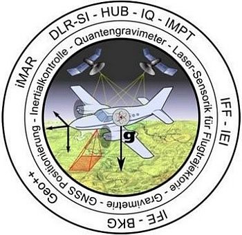
AeroQGrav (Absolute Aero Quantengravimetrie)
Laser Doppler Velocity Sensor (LDG) for measuring the vertical movements of the aircraft relative to the ground
Number FKZ 13N16519.
Introduction to AeroQGrav
The collaborative research project AeroQGrav aims to improve flight gravimetry technologies to achieve higher spatial and temporal resolution in gravity acceleration measurements. This will be achieved by developing a new quantum flight gravimeter (AeroQGrav) adapted to the needs of flight gravimetry.
In gravimetry on moving platforms, gravity is identified as the difference between an acceleration measurement by a gravimeter and the inertial acceleration during motion with respect to inertial space. Due to the continuous motion during the gravitational measurement, large-scale gravity field measurements can be made very efficiently using this method. Such measurements provide key information, e.g. for the identification of subsurface density anomalies, for the search for raw material deposits, for the determination of ocean currents or for the definition of reference surfaces for height reference systems.
Within the project AeroQGrav, a quantum gravimeter will be operated in an aircraft. Research will be conducted to improve both integral in-flight acceleration measurements - with the gravimeter and to determine the inertial motion. In this context, the technology of quantum gravimetry will be adapted for flight gravimetry, e.g. by mounting the sensor head on an inertial position-stabilized platform. Additionally, the reconstruction of the kinematic acceleration of the aircraft will be improved by GNSS supported by laser Doppler velocimetry as well as a terrestrial laser scanner. Finally, a precise data fusion of the different sensor systems used in the flight will enable to exploit the full advantage of the high accuracy of the quantum gravimeter.
Task of the IEI
Therefore, the aircraft's motion with respect to the Earth's surface will be measured using a highly precise method. Laser Doppler Vibrometers (LDV) are suitable for this purpose, as they can accurately measure relative velocities between the sensor and the measurement object, in this case, the Earth's surface.
To obtain accurate data on Earth acceleration, it is necessary to compensate for the inertial acceleration of the aircraft in the vertical axis. Consequently, the resolution of the quantum gravimeter is directly limited by knowing the vertical velocity of the aircraft, as this determines the inertial acceleration that must be subtracted from the gravimeter signal. Conventional methods for measuring vertical velocity cannot achieve the necessary resolutions, potentially limiting gravimeter measurements.
In the sub-project, the vertical velocity of the aircraft to the ground will be captured with a specially developed Laser Doppler Velocity Sensor (LDG) with a resolution on the order of 1 µm/s over an averaging time of five seconds. Velocity data will be recorded at a rate of 1 MSamples/s, with individual measurements having a correspondingly lower resolution. The high accuracy is achieved through short individual measurements with minimal cross-influences and the subsequent averaging over an extended period or low-pass filtering of the LDG's shot noise-limited velocity signal.
The planned sensor theoretically allows achieving the targeted acceleration resolutions, resolving a limitation in resolution due to inertial accelerations. This sub-project aims to research the methods and procedures for the technical implementation of an LDG.
AeroQGrav is a collaborative research project of iMAR Navigation, Geo++, TU Braunschweig, Leibniz Universität Hannover, Humboldt-Universität zu Berlin, Federal Agency for Cartography and Geodesy, TU Clausthal, and DLR, funded by the Federal Ministry of Education and Research (BMBF), FKZ 13N16519.

Scientific Assistant
E-Mail: tolchkova@iei.tu-clausthal.de
Scientific Assistant
E-Mail: wang@iei.tu-clausthal.de